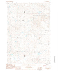
1983 Map of White Hill
USGS Topo · Published 1984About this map
Plateau terrain and remote plains define this 1983 topographic study along the border of Harding and Perkins counties. The map highlights a rural landscape shaped by water management and family history, most notably the White Hill Dam and the nearby White Hill Creek. Evidence of early settlement is preserved at the Henry Bingaman Cemetery, a key landmark for genealogists researching the families who worked this land. Infrastructure is sparse, centered on the Sorum Road and several wells that supported livestock or early homesteads in this part of northwestern South Dakota. This provisional survey captures the elevation and layout of the White Hill region during the early 1980s, reflecting a period of established ranching and continued agricultural use.
Find a feature on this map
9 named features on this map. Tap any name to fly to it.
Don’t see what you’re looking for? This feature index may not catch every label — zoom into the map to look around manually.
Map Details
Editions of this 1983 White Hill Map
This is the sole edition of this map. No revisions or reprints were ever made.
Other maps of this area

1935 · Reva
USGS Topo · 1:125,000

1935 · Hoover
USGS Topo · 1:125,000

1954 · Lemmon
USGS Topo · 1:250,000

1957 · Lemmon
USGS Topo · 1:250,000

1968 · Reva
USGS Topo · 1:24,000

1968 · Flat Top Butte
USGS Topo · 1:24,000

1969 · Reva NE
USGS Topo · 1:24,000

1980 · Redig
USGS Topo · 1:100,000

1980 · Camp Crook
USGS Topo · 1:100,000

1983 · Prairie City NE
USGS Topo · 1:24,000