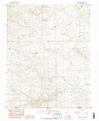
1986 Map of White Hills
USGS Topo · Published 1987About this map
The Virgin River and Santa Clara River carve through the arid topography of the Utah-Arizona borderlands in this mid-1980s study. The landscape is defined by the White Hills and South Hills, where the drainage patterns of Cove Wash, Cottonwood Wash, and Curly Hollow Wash illustrate the complex erosion of the high desert. Settlement is concentrated near the river corridors, with the town of Santa Clara in the north and the small outpost of Atkinville to the east. One of the more distinct cultural features is Blakes Lambing Grounds, suggesting the area's history with livestock and pastoral land use. The map also records early municipal expansion, noted by the St George Corp Bdy approaching Bloomington Bluff. Isolated water sources like Stucki Spring and the Curly Hollow Reservoir provide critical points of interest for researchers of local hydrology and ranching history.
Find a feature on this map
30 named features on this map. Tap any name to fly to it.
Don’t see what you’re looking for? This feature index may not catch every label — zoom into the map to look around manually.
Map Details
Editions of this 1986 White Hills Map
2 editions found
Other maps of this area

1885 · St. George
USGS Topo · 1:250,000

1886 · Mt. Trumbull
USGS Topo · 1:250,000

1891 · St. George
USGS Topo · 1:250,000

1892 · Mt. Trumbull
USGS Topo · 1:250,000

1953 · Cedar City
USGS Topo · 1:250,000

1953 · Grand Canyon
USGS Topo · 1:250,000

1954 · Beaver Dam Mts NE
USGS Topo · 1:24,000

1954 · Wolf Hole Mtn. NW
USGS Topo · 1:24,000

1954 · Beaver Dam Mts SE
USGS Topo · 1:24,000

1954 · Wolf Hole Mtn. NE
USGS Topo · 1:24,000