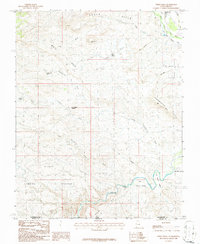
1986 Map of White Hills
USGS Topo · Published 1987About this map
Santa Clara and the surrounding high desert of the White Hills characterize this mid-1980s landscape at the boundary of Utah and Arizona. The Virgin River snakes through the southern portion of the map, cutting through First Narrows and creating distinct ecological zones such as Big Round Valley. This area represents a critical intersection of water resources and livestock history, evidenced by the large Blakes Lambing Grounds and numerous water sources including Stucki Spring, Cave Spring, and the Curly Hollow Reservoir.
Find a feature on this map
29 named features on this map. Tap any name to fly to it.
Don’t see what you’re looking for? This feature index may not catch every label — zoom into the map to look around manually.
Map Details
Editions of this 1986 White Hills Map
2 editions found
Other maps of this area

1885 · St. George
USGS Topo · 1:250,000

1886 · Mt. Trumbull
USGS Topo · 1:250,000

1891 · St. George
USGS Topo · 1:250,000

1892 · Mt. Trumbull
USGS Topo · 1:250,000

1953 · Cedar City
USGS Topo · 1:250,000

1953 · Grand Canyon
USGS Topo · 1:250,000

1954 · Beaver Dam Mts NE
USGS Topo · 1:24,000

1954 · Wolf Hole Mtn. NW
USGS Topo · 1:24,000

1954 · Beaver Dam Mts SE
USGS Topo · 1:24,000

1954 · Wolf Hole Mtn. NE
USGS Topo · 1:24,000