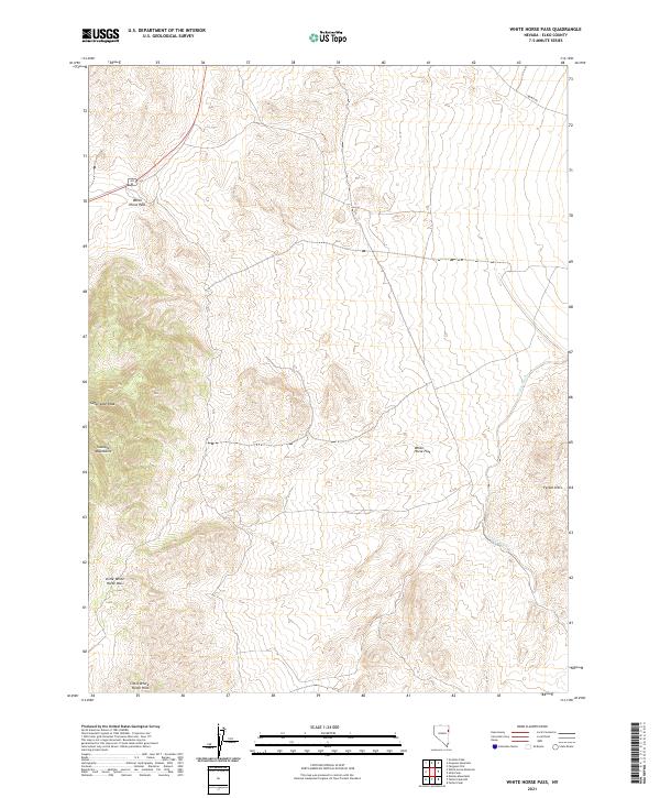
2021 Map of White Horse Pass
USGS Topo · Published 2021About this map
White Horse Pass serves as the primary gateway through the high terrain of Elko County, marking a critical crossing point for travelers using Alt 93. This corridor is flanked by the towering Goshute Mountains to the west and the expansive White Horse Flat to the east. The landscape is defined by its dramatic elevation changes, rising from the flatlands to the prominent Sugar Loaf Peak and the rolling Ferber Hills.
Find a feature on this map
14 named features on this map. Tap any name to fly to it.
Don’t see what you’re looking for? This feature index may not catch every label — zoom into the map to look around manually.
Map Details
Editions of this 2021 White Horse Pass Map
This is the sole edition of this map. No revisions or reprints were ever made.
Other maps of this area

1955 · Elko
USGS Topo · 1:250,000

1958 · Elko
USGS Topo · 1:250,000

1962 · Elko
USGS Topo · 1:250,000

1965 · Elko
USGS Topo · 1:250,000

1972 · Ferguson Flat
USGS Topo · 1:24,000

1972 · White Horse Pass
USGS Topo · 1:24,000

1972 · Utah Peak
USGS Topo · 1:24,000

1972 · Ferguson Mtn.
USGS Topo · 1:24,000
1982 · Kinsley Mountains
USGS Topo · 1:24,000
1982 · Goshute Peak
USGS Topo · 1:24,000