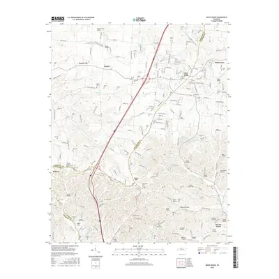
2016 Map of White House
USGS Topo · Published 2016About this map
White House serves as a primary hub where the borders of Robertson and Sumner counties meet, characterized by a transition from organized residential patterns to the intricate hollows and ridges of north-central Tennessee. The landscape is marked by a high density of family and community cemeteries, such as Cawthon Cem, Mount Pleasant Cem, and Latimer Cem, which reflect the deep-rooted genealogical history of the area. Flowing through the western reaches, the Sulphur Fork Red River and its various springs, including White Sulphur Spring and Red Sulphur Spring, suggest a terrain shaped by mineral-rich water sources.
Find a feature on this map
212 named features on this map. Tap any name to fly to it.
Don’t see what you’re looking for? This feature index may not catch every label — zoom into the map to look around manually.
Map Details
Editions of this 2016 White House Map
This is the sole edition of this map. No revisions or reprints were ever made.
Other maps of this area

1903 · Nashville
USGS Topo · 1:125,000

1931 · Ridgetop
USGS Topo · 1:62,500

1935 · Ridgetop
USGS Topo · 1:62,500

1942 · Gallatin
USGS Topo · 1:100,000

1952 · Goodlettsville
USGS Topo · 1:24,000

1952 · Youngville
USGS Topo · 1:24,000

1952 · Hendersonville
USGS Topo · 1:24,000

1953 · Cottontown
USGS Topo · 1:24,000

1953 · Orlinda
USGS Topo · 1:24,000
1954 · White House
USGS Topo · 1:24,000