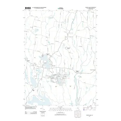
2013 Map of White Lake
USGS Topo · Published 2013About this map
White Lake and its neighboring waters form the centerpiece of this Sullivan County landscape, showing a dense network of lakeside communities and seasonal retreats. The settlement of Smallwood sits nestled between Gabriel Lake and Mountain Lake, while the village of Kauneonga Lake provides a northern anchor to the primary lakefront. This area is characterized by a high concentration of religious and memorial sites, including Temple Beth El, the Old Bethel Cem, and the Bethel Evergreen Cem, reflecting the cultural depth of the Jewish Catskills legacy.
Find a feature on this map
178 named features on this map. Tap any name to fly to it.
Don’t see what you’re looking for? This feature index may not catch every label — zoom into the map to look around manually.
Map Details
Editions of this 2013 White Lake Map
This is the sole edition of this map. No revisions or reprints were ever made.
Other maps of this area

1909 · Monticello
USGS Topo · 1:62,500

1910 · Neversink
USGS Topo · 1:62,500

1911 · Monticello
USGS Topo · 1:62,500

1921 · Livingston Manor
USGS Topo · 1:62,500

1922 · White Lake
USGS Topo · 1:62,500

1923 · Livingston Manor
USGS Topo · 1:62,500

1942 · White Lake
USGS Topo · 1:62,500

1942 · Neversink
USGS Topo · 1:62,500

1943 · White Lake
USGS Topo · 1:62,500

1943 · Monticello
USGS Topo · 1:62,500