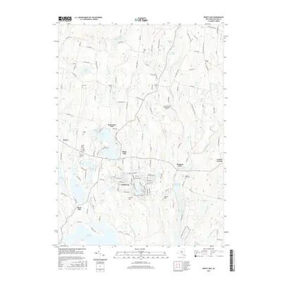
2016 Map of White Lake
USGS Topo · Published 2016About this map
Bethel and its surrounding resort communities define this landscape in the southern Catskill region, where the terrain is marked by a dense network of lakes and reservoirs. This area is characterized by a mix of historic hamlets and mid-century summer destinations like White Lake and Smallwood, which developed around the local water bodies. The presence of several distinct burial grounds, including the Temple Beth El Cem, Old Bethel Cem, and Bethel Evergreen Cem, provides a map for genealogists tracing local family histories. Water management and recreation are central to the geography, dominated by the Swinging Bridge Reservoir and the Mongaup River system. The Sullivan County International Airport stands as a modern landmark amidst older features like Lyon Cem and Stewart Cem, showing the ongoing integration of transportation infrastructure into a landscape traditionally defined by its brooks, ponds, and seasonal retreats.
Find a feature on this map
151 named features on this map. Tap any name to fly to it.
Don’t see what you’re looking for? This feature index may not catch every label — zoom into the map to look around manually.
Map Details
Editions of this 2016 White Lake Map
This is the sole edition of this map. No revisions or reprints were ever made.
Other maps of this area

1909 · Monticello
USGS Topo · 1:62,500

1910 · Neversink
USGS Topo · 1:62,500

1911 · Monticello
USGS Topo · 1:62,500

1921 · Livingston Manor
USGS Topo · 1:62,500

1922 · White Lake
USGS Topo · 1:62,500

1923 · Livingston Manor
USGS Topo · 1:62,500

1942 · White Lake
USGS Topo · 1:62,500

1942 · Neversink
USGS Topo · 1:62,500

1943 · White Lake
USGS Topo · 1:62,500

1943 · Monticello
USGS Topo · 1:62,500