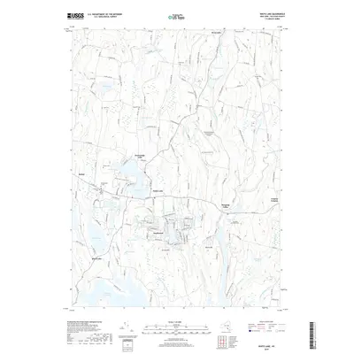
2019 Map of White Lake
USGS Topo · Published 2019About this map
Sullivan County International Airport serves as a modern anchor in this landscape of the Catskills, where recreational waters and rural settlements define the geography. The area around White Lake and Kauneonga Lake exhibits a dense concentration of shoreline development, including the White Lake Country Club, reflecting the region's long-standing draw for summer residents and visitors. Further south, the planned layout of Smallwood sits between Gabriel Lake and Greens Hill, showing a distinct grid pattern compared to the older, more dispersed hamlets like Bethel or Mongaup Valley. Family-named landmarks such as Stewart Cem, Lyon Cem, and Van Keuren Cem are scattered throughout the hills, providing valuable markers for genealogists. The southern portion is dominated by the northern reaches of the Toronto Reservoir and the winding course of the Mongaup River, illustrating the complex water management and natural drainage systems of the county.
Find a feature on this map
152 named features on this map. Tap any name to fly to it.
Don’t see what you’re looking for? This feature index may not catch every label — zoom into the map to look around manually.
Map Details
Editions of this 2019 White Lake Map
This is the sole edition of this map. No revisions or reprints were ever made.
Other maps of this area

1909 · Monticello
USGS Topo · 1:62,500

1910 · Neversink
USGS Topo · 1:62,500

1911 · Monticello
USGS Topo · 1:62,500

1921 · Livingston Manor
USGS Topo · 1:62,500

1922 · White Lake
USGS Topo · 1:62,500

1923 · Livingston Manor
USGS Topo · 1:62,500

1942 · White Lake
USGS Topo · 1:62,500

1942 · Neversink
USGS Topo · 1:62,500

1943 · White Lake
USGS Topo · 1:62,500

1943 · Monticello
USGS Topo · 1:62,500