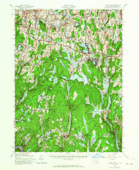
1943 Map of White Lake
USGS Topo · Published 1965About this map
Toronto Reservoir and the winding course of the Mongaup River dominate this mid-century portrait of Sullivan County, New York. The landscape is a complex network of glacial ponds and small settlements, reflecting a transition from traditional rural agriculture to a burgeoning recreational and summer resort era. Clusters of development around White Lake and North White Lake sit adjacent to more isolated agricultural outposts like Fowlerville and Dutch Settlement.
Find a feature on this map
82 named features on this map. Tap any name to fly to it.
Don’t see what you’re looking for? This feature index may not catch every label — zoom into the map to look around manually.
Map Details
Editions of this 1943 White Lake Map
2 editions found

Other maps of this area

1906 · Port Jervis
USGS Topo · 1:62,500

1908 · Port Jervis
USGS Topo · 1:62,500

1909 · Monticello
USGS Topo · 1:62,500

1910 · Neversink
USGS Topo · 1:62,500

1911 · Monticello
USGS Topo · 1:62,500

1913 · Milford
USGS Topo · 1:62,500

1915 · Milford
USGS Topo · 1:62,500

1920 · Long Eddy
USGS Topo · 1:62,500

1920 · Damascus
USGS Topo · 1:62,500

1921 · Long Eddy
USGS Topo · 1:48,000