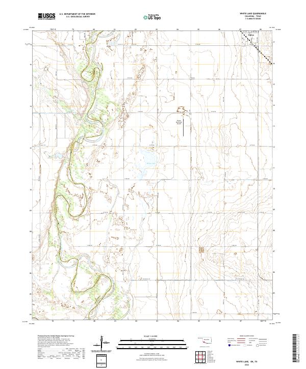
2022 Map of White Lake
USGS Topo · Published 2022About this map
Tipton anchors the northeast corner of this agricultural landscape in Southwest Oklahoma, where the town grid transitions into a vast network of section-line roads. The North Fork Red River snakes along the western edge of the map, serving as the natural boundary between Jackson and Tillman counties. This riparian corridor is marked by shifting sandbars and seasonal wetlands, contrasting with the structured irrigation and farming patterns of the surrounding plains. To the west of the settlement, the Tipton Municipal Airport and the isolated White Lake provide clear landmarks amidst the fields. The grid of rural routes, such as E 1740 RD and n2120 RD, illustrates the systematic land division of the region, which remains central to the local agrarian economy and settlement patterns.
Find a feature on this map
37 named features on this map. Tap any name to fly to it.
Don’t see what you’re looking for? This feature index may not catch every label — zoom into the map to look around manually.
Map Details
Editions of this 2022 White Lake Map
This is the sole edition of this map. No revisions or reprints were ever made.
Other maps of this area

1955 · Lawton
USGS Topo · 1:250,000

1958 · Frederick
USGS Topo · 1:62,500

1958 · Elmer
USGS Topo · 1:62,500

1963 · Altus SE
USGS Topo · 1:24,000

1964 · Tipton SE
USGS Topo · 1:24,000

1964 · Tipton
USGS Topo · 1:24,000

1975 · Elmore City NE
USGS Topo · 1:24,000

1975 · Frederick NE
USGS Topo · 1:24,000

1975 · Frederick SW
USGS Topo · 1:24,000

1975 · Frederick NW
USGS Topo · 1:24,000