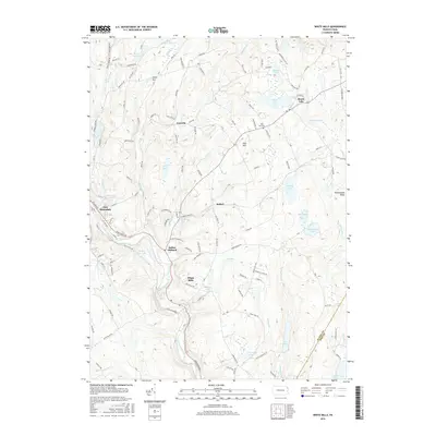
2016 Map of White Mills
USGS Topo · Published 2016About this map
The Lackawaxen River corridor defines the south-central portion of this map, winding past the historic glass-making hub of White Mills and the nearby settlement of Indian Orchard. This 2016 survey illustrates the persistent rural character of the Pennsylvania borderlands between Wayne and Pike counties, where the river's path is closely followed by the rail line and Route 6. To the north, the plateau is marked by a series of high-elevation glacial lakes and ponds including Beach Lake, Chestnut Lake, and the smaller Vine Hill community, where the Vine Hill Cem serves as a local genealogical marker. The landscape is characterized by its numerous water bodies, from Lake Constance in the south to Bunnells Pond near East Honesdale, showing how the geography of the northern Poconos region continues to be shaped by its natural drainage patterns and small upland hamlets like Laurella and Bethel.
Find a feature on this map
138 named features on this map. Tap any name to fly to it.
Don’t see what you’re looking for? This feature index may not catch every label — zoom into the map to look around manually.
Map Details
Editions of this 2016 White Mills Map
This is the sole edition of this map. No revisions or reprints were ever made.
Other maps of this area

1892 · Honesdale
USGS Topo · 1:62,500

1920 · Damascus
USGS Topo · 1:62,500

1923 · Damascus
USGS Topo · 1:62,500

1928 · Ariel
USGS Topo · 1:62,500

1932 · Ariel
USGS Topo · 1:62,500

1935 · Hawley
USGS Topo · 1:62,500

1938 · Hawley
USGS Topo · 1:62,500

1943 · Honesdale
USGS Topo · 1:125,000

1944 · Damascus
USGS Topo · 1:62,500

1946 · Honesdale
USGS Topo · 1:24,000
Featured Places
- Lackawaxen Township, PA
- Honesdale, PA
- Damascus Township, PA
- Cherry Ridge Township, PA
- Dyberry Township, PA