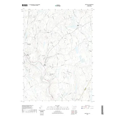
2019 Map of White Mills
USGS Topo · Published 2019About this map
The Lackawaxen River corridor defines the southwest portion of this quadrangle, where the industrial hamlets of White Mills and Indian Orchard sit at the intersection of water and historic turnpikes. This landscape reflects a deep history of transport and trade, evidenced by the Honesdale and Delaware Tpke and the Owego Tpke, which cut across the plateaus above the river valley. To the east, the terrain rises toward Vine Hill and Rattlesnake Ridge, giving way to a high-country environment of small lakes and ponds including Beach Lake and Suydam Pond. The settlement pattern is dispersed, with small nodes like Bethel and Laurella connected by winding roads like Carley Brook Rd and Bunnell Pond Rd, while the Vine Hill Cem remains a quiet landmark of the local community.
Find a feature on this map
118 named features on this map. Tap any name to fly to it.
Don’t see what you’re looking for? This feature index may not catch every label — zoom into the map to look around manually.
Map Details
Editions of this 2019 White Mills Map
This is the sole edition of this map. No revisions or reprints were ever made.
Other maps of this area

1892 · Honesdale
USGS Topo · 1:62,500

1920 · Damascus
USGS Topo · 1:62,500

1923 · Damascus
USGS Topo · 1:62,500

1928 · Ariel
USGS Topo · 1:62,500

1932 · Ariel
USGS Topo · 1:62,500

1935 · Hawley
USGS Topo · 1:62,500

1938 · Hawley
USGS Topo · 1:62,500

1943 · Honesdale
USGS Topo · 1:125,000

1944 · Damascus
USGS Topo · 1:62,500

1946 · Honesdale
USGS Topo · 1:24,000
Featured Places
- Lackawaxen Township, PA
- Honesdale, PA
- Damascus Township, PA
- Cherry Ridge Township, PA
- Dyberry Township, PA