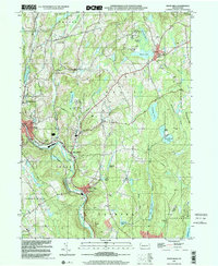
1999 Map of White Mills
USGS Topo · Published 2001About this map
The Lackawaxen River flows through the heart of this Wayne County landscape, anchoring the namesake community of White Mills. This region is characterized by a high concentration of recreational and community infrastructure, notably seen in the cluster of seasonal camps like Camp Munsee, Camp Moshava, and Camp Navajo near Beach Lake. The settlement pattern reflects a deeply rooted rural society, with numerous houses of worship such as St Bernards Ch and Bethel Ch serving dispersed hamlets like Berlin Center and Laurella.
Find a feature on this map
64 named features on this map. Tap any name to fly to it.
Don’t see what you’re looking for? This feature index may not catch every label — zoom into the map to look around manually.
Map Details
Editions of this 1999 White Mills Map
This is the sole edition of this map. No revisions or reprints were ever made.
Other maps of this area

1892 · Honesdale
USGS Topo · 1:62,500

1920 · Damascus
USGS Topo · 1:62,500

1923 · Damascus
USGS Topo · 1:62,500

1928 · Ariel
USGS Topo · 1:62,500

1932 · Ariel
USGS Topo · 1:62,500

1935 · Hawley
USGS Topo · 1:62,500

1938 · Hawley
USGS Topo · 1:62,500

1943 · Honesdale
USGS Topo · 1:125,000

1944 · Damascus
USGS Topo · 1:62,500

1946 · Honesdale
USGS Topo · 1:24,000
Featured Places
- Lackawaxen Township, PA
- Honesdale, PA
- Damascus Township, PA
- Cherry Ridge Township, PA
- Dyberry Township, PA