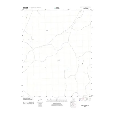
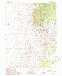
2010 Map of White Mountain
USGS Topo · Published 2010About this map
Wah Wah Valley defines the western expanse of this high-desert landscape in Beaver County, where drainage patterns are shaped by the long descent of Grover Wash. The topography is dominated by distinct volcanic and sedimentary formations, including the prominent Antelope Peak in the north and the namesake White Mountain toward the center. This 2010 survey illustrates a sparsely settled region of the eastern Great Basin, where water sources like Mertons Spring were historically critical for livestock and passage. To the southeast, the terrain rises into the Shauntie Hills, marking the transition from the valley floor to the upland ridges that characterize this part of southwest Utah.
Find a feature on this map
6 named features on this map. Tap any name to fly to it.
Don’t see what you’re looking for? This feature index may not catch every label — zoom into the map to look around manually.
Map Details
Editions of this 2010 White Mountain Map
This is the sole edition of this map. No revisions or reprints were ever made.
Other maps of this area

1953 · Richfield
USGS Topo · 1:250,000

1958 · Richfield
USGS Topo · 1:250,000

1958 · Thermo
USGS Topo · 1:62,500

1958 · Milford
USGS Topo · 1:62,500

1959 · Frisco
USGS Topo · 1:62,500
1971 · Burns Knoll
USGS Topo · 1:24,000
1971 · Blue Mountain
USGS Topo · 1:24,000

1980 · Wah Wah Mts. South
USGS Topo · 1:100,000
1989 · Frisco SW
USGS Topo · 1:24,000
1989 · Frisco
USGS Topo · 1:24,000