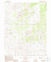
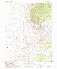
1989 Map of White Mountain
USGS Topo · Published 1989About this map
Shauntie Hills and the eastern edge of the Wah Wah Valley define this desert landscape in Beaver County, Utah. The terrain is characterized by numerous unnamed prospects and a few marked Mine locations, indicating a history of mineral exploration in the rugged hills. Water management in this arid environment is evidenced by sparse but critical features such as Seveys Well, Mertons Spring, and Guzzler catchments. High points like White Mountain and Antelope Peak provide the primary landmarks for navigation across the high desert, while seasonal drainages like Grover Wash cut through the alluvial fans. This 1980s data, updated from earlier mid-century surveys, shows a region largely defined by its topography and subsurface potential rather than permanent settlement.
Find a feature on this map
14 named features on this map. Tap any name to fly to it.
Don’t see what you’re looking for? This feature index may not catch every label — zoom into the map to look around manually.
Map Details
Editions of this 1989 White Mountain Map
This is the sole edition of this map. No revisions or reprints were ever made.
Other maps of this area

1953 · Richfield
USGS Topo · 1:250,000

1958 · Richfield
USGS Topo · 1:250,000

1958 · Thermo
USGS Topo · 1:62,500

1958 · Milford
USGS Topo · 1:62,500

1959 · Frisco
USGS Topo · 1:62,500
1971 · Burns Knoll
USGS Topo · 1:24,000
1971 · Blue Mountain
USGS Topo · 1:24,000

1980 · Wah Wah Mts. South
USGS Topo · 1:100,000
1989 · Frisco SW
USGS Topo · 1:24,000
1989 · Frisco
USGS Topo · 1:24,000