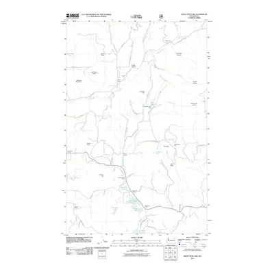
2011 Map of White Mud Lake
USGS Topo · Published 2011About this map
Old Dominion Mine sits southeast of The Knob, marking a landscape defined by its extractive history and rural social hubs in Stevens County. In the early 21st century, the area around White Mud Lake and White Lake remained anchored by community institutions like the White Lake Grange and the White Lake School. The terrain is deeply articulated by numerous gulches and canyons, including Blue Bird Canyon and Finley Gulch, while industry is represented by the Tulare Dolomite Quarry and Hawkins Quarry. A network of creeks, most notably Mill Creek and Truman Wood Creek, flows between prominent heights like Old Town Mountain and Coonrad Hill, illustrating the complex drainage patterns of this corner of Washington state.
Find a feature on this map
63 named features on this map. Tap any name to fly to it.
Don’t see what you’re looking for? This feature index may not catch every label — zoom into the map to look around manually.
Map Details
Editions of this 2011 White Mud Lake Map
This is the sole edition of this map. No revisions or reprints were ever made.
Other maps of this area

1927 · Chewelah
USGS Topo · 1:125,000

1929 · Colville
USGS Topo · 1:125,000

1930 · Chewelah
USGS Topo · 1:125,000

1933 · Colville
USGS Topo · 1:125,000

1952 · Gillette Mtn
USGS Topo · 1:24,000

1952 · Echo Valley
USGS Topo · 1:24,000

1952 · White Mud Lake
USGS Topo · 1:24,000

1952 · Aladdin
USGS Topo · 1:24,000

1952 · Colville
USGS Topo · 1:24,000

1958 · Sandpoint
USGS Topo · 1:250,000