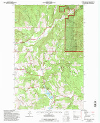
1992 Map of White Mud Lake
USGS Topo · Published 1997About this map
Colville National Forest dominates the eastern half of this terrain, where Blue Bird Canyon and Iron Mountain overlook a landscape shaped by early Stevens County history. The western reaches are defined by a network of ridges and gulches, including Churchill Ridge and Dry Gulch, which descend toward the agricultural flats. This 1992 revision by the U.S. Forest Service documents the legacy of early regional hubs, specifically marking the Pinkney City (Site) and Three Forks (Site). The transition from early 20th-century life is evident in the inclusion of several shuttered institutions, such as the Graham Sch (Aband) and White Lake Sch (Aband). Water remains a focal point in the valley, with White Mud Lake, Keogh Lake, and Hatch Lake clustered south of Prouty Corners.
Find a feature on this map
45 named features on this map. Tap any name to fly to it.
Don’t see what you’re looking for? This feature index may not catch every label — zoom into the map to look around manually.
Map Details
Editions of this 1992 White Mud Lake Map
This is the sole edition of this map. No revisions or reprints were ever made.
Other maps of this area

1927 · Chewelah
USGS Topo · 1:125,000

1929 · Colville
USGS Topo · 1:125,000

1930 · Chewelah
USGS Topo · 1:125,000

1933 · Colville
USGS Topo · 1:125,000

1952 · Gillette Mtn
USGS Topo · 1:24,000

1952 · Echo Valley
USGS Topo · 1:24,000

1952 · White Mud Lake
USGS Topo · 1:24,000

1952 · Aladdin
USGS Topo · 1:24,000

1952 · Colville
USGS Topo · 1:24,000

1958 · Sandpoint
USGS Topo · 1:250,000