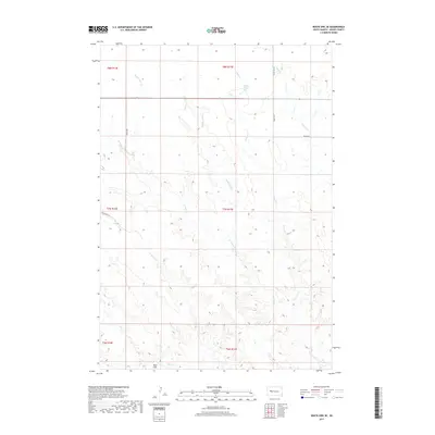
2017 Map of White Owl SE
USGS Topo · Published 2017About this map
Kent Flat lies in the southern reach of this Meade County landscape, where the drainage patterns of the northern Great Plains dictate the movement of water and travel. The area is defined by a dense network of seasonal waterways, including the winding courses of Middle Fork Cr, E Tepee Cr, and W Tepee Cr. These creeks carve through the terrain, creating a complex series of draws and ridges that typify the rural topography of western South Dakota.
Find a feature on this map
18 named features on this map. Tap any name to fly to it.
Don’t see what you’re looking for? This feature index may not catch every label — zoom into the map to look around manually.
Map Details
Editions of this 2017 White Owl SE Map
This is the sole edition of this map. No revisions or reprints were ever made.
Other maps of this area

1953 · Rapid City
USGS Topo · 1:250,000

1954 · Dalzell NW
USGS Topo · 1:24,000

1954 · Dalzell NE
USGS Topo · 1:24,000

1955 · Pedro NW
USGS Topo · 1:24,000

1957 · Rapid City
USGS Topo · 1:250,000

1983 · Whiteman Owl NW
USGS Topo · 1:24,000

1983 · Plainview
USGS Topo · 1:24,000

1983 · Whiteman Owl
USGS Topo · 1:24,000
1983 · Whiteman Owl SE
USGS Topo · 1:24,000

1983 · Marcus
USGS Topo · 1:24,000