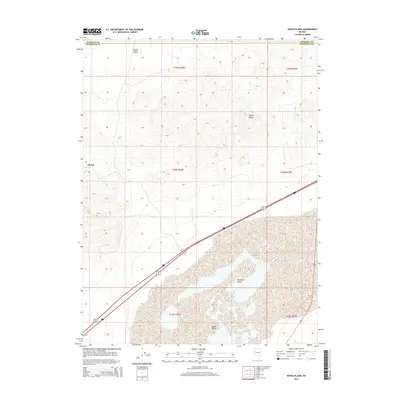
2014 Map of White Plains
USGS Topo · Published 2014About this map
Trinity Range peaks dominate the northern portion of this Churchill County landscape, giving way to the expansive floor of the Fortymile Desert in the south. The arid terrain is punctuated by historical markers of human presence, most notably the settlement of Jessup on the western edge of the range and White Plains situated near the desert flats. This area of Nevada is characterized by its wide-open basins and parallel mountain blocks, a pattern clearly visible in the relationship between Copper Valley and the surrounding heights. Modern infrastructure follows the path of least resistance across the desert, with Alt 95 cutting a long diagonal path through the lower reaches of the quadrangle, connecting these remote outposts to the wider regional network.
Find a feature on this map
13 named features on this map. Tap any name to fly to it.
Don’t see what you’re looking for? This feature index may not catch every label — zoom into the map to look around manually.
Map Details
Editions of this 2014 White Plains Map
This is the sole edition of this map. No revisions or reprints were ever made.
Other maps of this area

1908 · Carson Sink
USGS Topo · 1:250,000

1910 · Carson Sink
USGS Topo · 1:250,000

1931 · Lovelock
USGS Topo · 1:250,000

1935 · Lovelock
USGS Topo · 1:250,000

1951 · Carson Sink
USGS Topo · 1:62,500

1951 · Desert Peak
USGS Topo · 1:62,500

1955 · Lovelock
USGS Topo · 1:250,000

1956 · Toulon
USGS Topo · 1:62,500

1957 · Reno
USGS Topo · 1:250,000

1959 · Lovelock
USGS Topo · 1:250,000