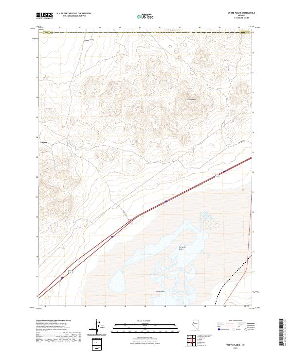
2021 Map of White Plains
USGS Topo · Published 2021About this map
Fortymile Desert dominates the southeastern expanse of this Nevada landscape, representing the harsh terrain encountered by nineteenth-century emigrants on the trail to California. The map documents a sparsely populated region where the Trinity Range provides a stark topographical boundary between the arid lowlands and the Copper Valley to the north. Evidence of human presence is concentrated around the namesake White Plains and the settlement of Jessup in the western reaches. The intersection of modern infrastructure with historical paths is visible along the Frontage Rd, which traces a path through the Churchill and Pershing county lines. This area reflects the enduring isolation of the western Great Basin, where wide-reaching desert plains are interrupted only by scattered peaks and the geometric precision of the Public Land Survey System.
Find a feature on this map
13 named features on this map. Tap any name to fly to it.
Don’t see what you’re looking for? This feature index may not catch every label — zoom into the map to look around manually.
Map Details
Editions of this 2021 White Plains Map
This is the sole edition of this map. No revisions or reprints were ever made.
Other maps of this area

1908 · Carson Sink
USGS Topo · 1:250,000

1910 · Carson Sink
USGS Topo · 1:250,000

1931 · Lovelock
USGS Topo · 1:250,000

1935 · Lovelock
USGS Topo · 1:250,000

1951 · Carson Sink
USGS Topo · 1:62,500

1951 · Desert Peak
USGS Topo · 1:62,500

1955 · Lovelock
USGS Topo · 1:250,000

1956 · Toulon
USGS Topo · 1:62,500

1957 · Reno
USGS Topo · 1:250,000

1959 · Lovelock
USGS Topo · 1:250,000