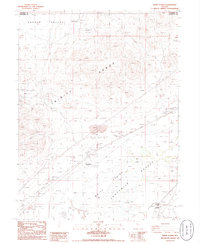
1986 Map of White Plains
USGS Topo · Published 1986About this map
Trinity Range peaks and the expansive Fortymile Plains define the high-desert geography of this mid-1980s provisional survey. The landscape is a stark map of Great Basin industry and transit, marked by the extensive Central Jessup District Mining Area and the isolated Copper Queen Mine. Evidence of early Nevada movement is visible in the long stretches of Railroad Grade and the location of Humboldt Double Wells near the southern edge of the quadrangle.
Find a feature on this map
25 named features on this map. Tap any name to fly to it.
Don’t see what you’re looking for? This feature index may not catch every label — zoom into the map to look around manually.
Map Details
Editions of this 1986 White Plains Map
This is the sole edition of this map. No revisions or reprints were ever made.
Other maps of this area

1908 · Carson Sink
USGS Topo · 1:250,000

1910 · Carson Sink
USGS Topo · 1:250,000

1931 · Lovelock
USGS Topo · 1:250,000

1935 · Lovelock
USGS Topo · 1:250,000

1951 · Carson Sink
USGS Topo · 1:62,500

1951 · Desert Peak
USGS Topo · 1:62,500

1955 · Lovelock
USGS Topo · 1:250,000

1956 · Toulon
USGS Topo · 1:62,500

1957 · Reno
USGS Topo · 1:250,000

1959 · Lovelock
USGS Topo · 1:250,000