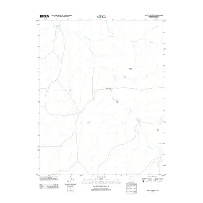
2011 Map of White Pockets
USGS Topo · Published 2011About this map
Clayhole Wash and Sandridge Wash carve through this remote section of the Arizona Strip, defining a landscape where water management is central to the history of land use. In the early 21st century, these ephemeral drainages are punctuated by vital infrastructure for ranching and survival in the high desert, including the White Pockets Windmill and several catchment features. Reservoirs such as Rockhole Pocket Reservoir and Harolds Reservoir appear alongside natural depressions like Snake Pond, showing the essential network of watering holes in this arid environment.
Find a feature on this map
13 named features on this map. Tap any name to fly to it.
Don’t see what you’re looking for? This feature index may not catch every label — zoom into the map to look around manually.
Map Details
Editions of this 2011 White Pockets Map
This is the sole edition of this map. No revisions or reprints were ever made.
Other maps of this area

1886 · Mt. Trumbull
USGS Topo · 1:250,000

1892 · Mt. Trumbull
USGS Topo · 1:250,000

1953 · Grand Canyon
USGS Topo · 1:250,000

1954 · Lost Spring SE
USGS Topo · 1:24,000

1954 · Hurricane Cliffs 2 NE
USGS Topo · 1:24,000
1954 · Lost Spring NW
USGS Topo · 1:24,000
1954 · Lost Spring Mtn
USGS Topo · 1:62,500
1956 · Lost Spring NE
USGS Topo · 1:24,000

1957 · Grand Canyon
USGS Topo · 1:250,000

1958 · Grand Canyon
USGS Topo · 1:250,000