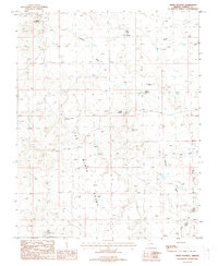
1988 Map of White Pockets
USGS Topo · Published 1988About this map
The Black Rocks dominate the central landscape of this Mohave County region, anchoring a terrain defined by desert water management and livestock infrastructure in the late 1980s. The map reveals a complex network of ranching and survival resources, including isolated outposts like White Pockets Windmill and several named water sources such as Burt Well and Childers Well. The distribution of Corral sites and the presence of the Navajo Trail suggest long-standing movement patterns across this arid basin.
Find a feature on this map
21 named features on this map. Tap any name to fly to it.
Don’t see what you’re looking for? This feature index may not catch every label — zoom into the map to look around manually.
Map Details
Editions of this 1988 White Pockets Map
This is the sole edition of this map. No revisions or reprints were ever made.
Other maps of this area

1886 · Mt. Trumbull
USGS Topo · 1:250,000

1892 · Mt. Trumbull
USGS Topo · 1:250,000

1953 · Grand Canyon
USGS Topo · 1:250,000

1954 · Lost Spring SE
USGS Topo · 1:24,000

1954 · Hurricane Cliffs 2 NE
USGS Topo · 1:24,000
1954 · Lost Spring NW
USGS Topo · 1:24,000
1954 · Lost Spring Mtn
USGS Topo · 1:62,500
1956 · Lost Spring NE
USGS Topo · 1:24,000

1957 · Grand Canyon
USGS Topo · 1:250,000

1958 · Grand Canyon
USGS Topo · 1:250,000