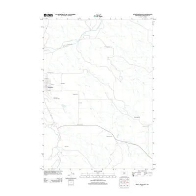
2012 Map of White River East
USGS Topo · Published 2012About this map
The town of White River serves as the focal point of this South Dakota landscape, situated near the winding course of the Little White River. The map reveals a land defined by significant ranching operations, with numerous family-named properties such as Hutchinson Ranch, Clifford Hight Ranch, and Dolezal Ranch spread across the territory. This pattern reflects the enduring agricultural heritage of Mellette County, where large landholdings are a primary feature of the geography. The terrain is notably varied, featuring the Little Badlands to the southeast, a distinctive geological formation that contrasts with the surrounding plains. Infrastructure to support this remote community is evident in the presence of the White River Municipal Airport and a small grid of local streets including State St and S 4th St, providing essential connections for the town and the outlying ranches like Gene Strain Ranch and Didier Ranch.
Find a feature on this map
18 named features on this map. Tap any name to fly to it.
Don’t see what you’re looking for? This feature index may not catch every label — zoom into the map to look around manually.
Map Details
Editions of this 2012 White River East Map
This is the sole edition of this map. No revisions or reprints were ever made.
Other maps of this area

1951 · White River NE
USGS Topo · 1:24,000

1951 · Westover
USGS Topo · 1:24,000

1951 · Murdo 3 NE
USGS Topo · 1:24,000

1955 · Martin
USGS Topo · 1:250,000

1958 · Martin
USGS Topo · 1:250,000

1969 · Soldier Creek NE
USGS Topo · 1:24,000

1969 · Mission NW
USGS Topo · 1:24,000

1982 · Mission NE
USGS Topo · 1:24,000

1982 · White River SE
USGS Topo · 1:24,000

1982 · White River East
USGS Topo · 1:24,000
Featured Places
- White River, SD
- Swift Bear Segment, SD
- Horse Creek Segment, SD
- Horse Creek, Horse Creek Segment
- Butte Creek Segment, SD