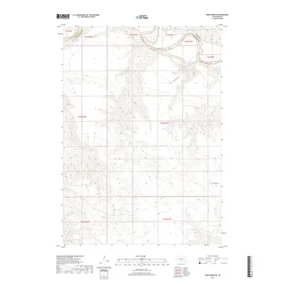
2017 Map of White River NE
USGS Topo · Published 2017About this map
The White River winds along the northern boundary of this landscape, carving a distinctive river valley that separates Mellette County from Jones County. This 2017 survey illustrates the complex drainage patterns of the high plains, where the intermittent Kaiser Cr and its numerous unnamed tributaries have deeply dissected the terrain, creating a network of ridges and draws. Movement across this rural territory is defined by primitive and secondary routes such as Yellow Eagle Rd in the north and Ironwing Rd in the southeast. The land is largely organized by the Public Land Survey System, with township and range lines like t43n r27w marking the expansive, open character of the South Dakota prairie. For the researcher or genealogist, the map provides a clear look at the topography and watercourses that dictated early travel and land use in the Swift Bear Segment.
Find a feature on this map
14 named features on this map. Tap any name to fly to it.
Don’t see what you’re looking for? This feature index may not catch every label — zoom into the map to look around manually.
Map Details
Editions of this 2017 White River NE Map
This is the sole edition of this map. No revisions or reprints were ever made.
Other maps of this area

1951 · Murdo SE
USGS Topo · 1:24,000

1951 · White River NE
USGS Topo · 1:24,000

1951 · Westover
USGS Topo · 1:24,000

1951 · Badnation NW
USGS Topo · 1:24,000

1951 · Murdo SW
USGS Topo · 1:24,000

1955 · Martin
USGS Topo · 1:250,000

1958 · Martin
USGS Topo · 1:250,000

1970 · Vivian SW
USGS Topo · 1:24,000

1982 · White River SE
USGS Topo · 1:24,000

1982 · Wood North
USGS Topo · 1:24,000