
1951 Map of Murdo SW
USGS Topo · Published 1953About this map
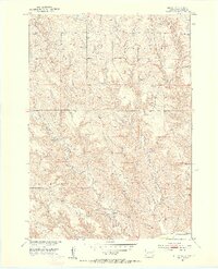
The Missouri River Basin development program shaped the mapping of this Jones County landscape in the early 1950s. The terrain is defined by the winding course of Horse Creek, which draws together several smaller tributaries including the West Fork and East Fork. This area of South Dakota reflects a mid-century rural schoolhouse network that was still very much intact at the time of the field check, providing a clear record of local educational geography before the consolidation of rural districts. The map documents two such specific institutions, East Buffalo Sch and West Buffalo Sch, positioned as central landmarks for the surrounding homesteads. Large regional labels for Murdo Buffalo and Mullen denote the broader land divisions and survey areas that characterize this part of the Great Plains during the postwar era.
Find a feature on this map
7 named features on this map. Tap any name to fly to it.
Don’t see what you’re looking for? This feature index may not catch every label — zoom into the map to look around manually.
Map Details
Editions of this 1951 Murdo SW Map
3 editions found
Other maps of this area

1951 · Murdo SE
USGS Topo · 1:24,000

1951 · White River NE
USGS Topo · 1:24,000

1951 · Westover
USGS Topo · 1:24,000

1951 · Murdo 3 NE
USGS Topo · 1:24,000

1951 · Okaton SE
USGS Topo · 1:24,000

1955 · Martin
USGS Topo · 1:250,000

1958 · Martin
USGS Topo · 1:250,000

1972 · Draper
USGS Topo · 1:24,000

1972 · Murdo
USGS Topo · 1:24,000
1972 · Okaton NE
USGS Topo · 1:24,000