
1972 Map of Murdo
USGS Topo · Published 1975About this map
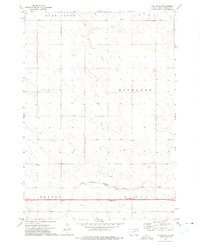
Murdo serves as the focal point of this Jones County survey, situated at the intersection of the Chicago Milwaukee St Paul and Pacific railroad and the expanding interstate highway system. The town's local infrastructure is well-defined, featuring the Roadside Park, Murdo Golf Course, and a Sewage Disposal Pond south of the main settlement. Further south, the Murdo Cem provides a point of interest for genealogists tracing family roots in the area.
Find a feature on this map
18 named features on this map. Tap any name to fly to it.
Don’t see what you’re looking for? This feature index may not catch every label — zoom into the map to look around manually.
Map Details
Editions of this 1972 Murdo Map
This is the sole edition of this map. No revisions or reprints were ever made.
Other maps of this area

1951 · Murdo SE
USGS Topo · 1:24,000

1951 · Murdo SW
USGS Topo · 1:24,000

1951 · Okaton SE
USGS Topo · 1:24,000

1951 · Capa SE
USGS Topo · 1:24,000

1954 · Pierre
USGS Topo · 1:250,000

1955 · Martin
USGS Topo · 1:250,000

1958 · Pierre
USGS Topo · 1:250,000

1958 · Martin
USGS Topo · 1:250,000

1972 · Draper
USGS Topo · 1:24,000
1972 · Okaton NE
USGS Topo · 1:24,000