
1936 Map of White River
USGS Topo · Published 1936About this map
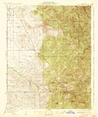
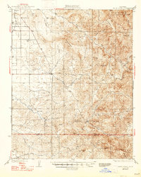
Deer Creek Colony and the nearby settlement of Ultra anchor the western edge of this landscape as it appeared in the mid-1930s. The terrain transitions from these lower agricultural and residential pockets into the ascending peaks of the Sierra Nevada foothills, where Tennessee Ridge and Meadow Mountain dominate the skyline. The northeast corner of the sheet is occupied by a portion of the Tule River Indian Reservation, showcasing the higher elevations around Oat Mtn and Gibbon Peak.
Find a feature on this map
31 named features on this map. Tap any name to fly to it.
Don’t see what you’re looking for? This feature index may not catch every label — zoom into the map to look around manually.
Map Details
Editions of this 1936 White River Map
3 editions found
Other maps of this area

1904 · Kaweah
USGS Topo · 1:125,000

1909 · Kaweah
USGS Topo · 1:125,000

1920 · Delonagha
USGS Topo · 1:62,500

1926 · Quincy School
USGS Topo · 1:31,680

1926 · Glennville
USGS Topo · 1:62,500

1929 · Richgrove
USGS Topo · 1:31,680

1929 · Porterville
USGS Topo · 1:31,680

1929 · Quincy School
USGS Topo · 1:31,680

1929 · Ducor
USGS Topo · 1:31,680

1931 · Deepwell Ranch
USGS Topo · 1:31,680