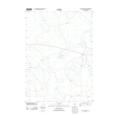
2012 Map of White River West
USGS Topo · Published 2012About this map
Ranching operations define this Mellette County landscape, where the Little White River and its tributaries carve through the plains. The spatial arrangement of family-held properties such as the Jensen Ranch, Stromer Ranch, and Lawrence Krogman Ranch illustrates a decentralized settlement pattern typical of South Dakota's modern grazing economy. Water remains the primary geographical anchor for these holdings, with Pine Cr and Dry Cr providing vital drainage across the terrain.
Find a feature on this map
17 named features on this map. Tap any name to fly to it.
Don’t see what you’re looking for? This feature index may not catch every label — zoom into the map to look around manually.
Map Details
Editions of this 2012 White River West Map
This is the sole edition of this map. No revisions or reprints were ever made.
Other maps of this area

1951 · Westover
USGS Topo · 1:24,000

1951 · Murdo 3 NW
USGS Topo · 1:24,000

1951 · Murdo 3 NE
USGS Topo · 1:24,000

1955 · Martin
USGS Topo · 1:250,000

1958 · Martin
USGS Topo · 1:250,000

1969 · Soldier Creek NE
USGS Topo · 1:24,000

1969 · Mission NW
USGS Topo · 1:24,000

1969 · Soldier Creek NW
USGS Topo · 1:24,000
1982 · Murdo 3 NW
USGS Topo · 1:25,000

1982 · White River East
USGS Topo · 1:24,000