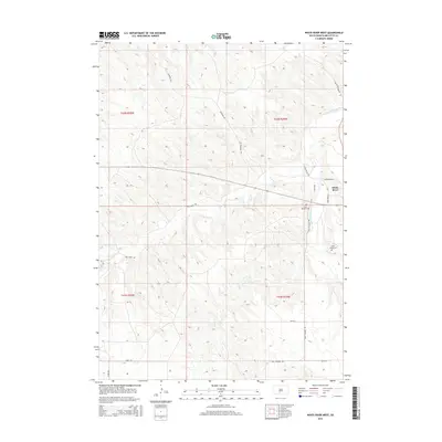
2015 Map of White River West
USGS Topo · Published 2015About this map
The town of White River serves as a focal point in this portion of Mellette County, situated near the confluence of several vital watercourses. The landscape is defined by the winding path of the Little White River and its tributaries, including Pine Cr and Dry Cr, which carve through the high plains terrain. Local family names and community history are preserved in the presence of Saint Ignatius Cem and Saint James Cem, providing valuable touchpoints for genealogical research. The local road network, with names like Ridgeway Rd, White Feather Rd, and Swift Bear Ln, reflects the cultural heritage of the region. This 2015 survey details the intersection of modern infrastructure, such as Power Dam Rd, with traditional land divisions across townships like T42N R29W and T41N R30W.
Find a feature on this map
21 named features on this map. Tap any name to fly to it.
Don’t see what you’re looking for? This feature index may not catch every label — zoom into the map to look around manually.
Map Details
Editions of this 2015 White River West Map
This is the sole edition of this map. No revisions or reprints were ever made.
Other maps of this area

1951 · Westover
USGS Topo · 1:24,000

1951 · Murdo 3 NW
USGS Topo · 1:24,000

1951 · Murdo 3 NE
USGS Topo · 1:24,000

1955 · Martin
USGS Topo · 1:250,000

1958 · Martin
USGS Topo · 1:250,000

1969 · Soldier Creek NE
USGS Topo · 1:24,000

1969 · Mission NW
USGS Topo · 1:24,000

1969 · Soldier Creek NW
USGS Topo · 1:24,000
1982 · Murdo 3 NW
USGS Topo · 1:25,000

1982 · White River East
USGS Topo · 1:24,000