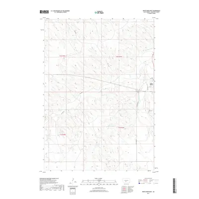
2017 Map of White River West
USGS Topo · Published 2017About this map
White River serves as the primary settlement on this western South Dakota landscape, situated near the confluence of local drainages and the Little White River. The terrain is defined by the dissected plateau typical of Mellette County, where various creeks carve through the plains. Local history is anchored by sites such as Saint Ignatius Cem, which sits just outside the main town center. The 2017 survey reflects the modern road network and land divisions while preserving the locations of community landmarks that have long served this rural region.
Find a feature on this map
3 named features on this map. Tap any name to fly to it.
Don’t see what you’re looking for? This feature index may not catch every label — zoom into the map to look around manually.
Map Details
Editions of this 2017 White River West Map
This is the sole edition of this map. No revisions or reprints were ever made.
Other maps of this area

1951 · Westover
USGS Topo · 1:24,000

1951 · Murdo 3 NW
USGS Topo · 1:24,000

1951 · Murdo 3 NE
USGS Topo · 1:24,000

1955 · Martin
USGS Topo · 1:250,000

1958 · Martin
USGS Topo · 1:250,000

1969 · Soldier Creek NE
USGS Topo · 1:24,000

1969 · Mission NW
USGS Topo · 1:24,000

1969 · Soldier Creek NW
USGS Topo · 1:24,000
1982 · Murdo 3 NW
USGS Topo · 1:25,000

1982 · White River East
USGS Topo · 1:24,000