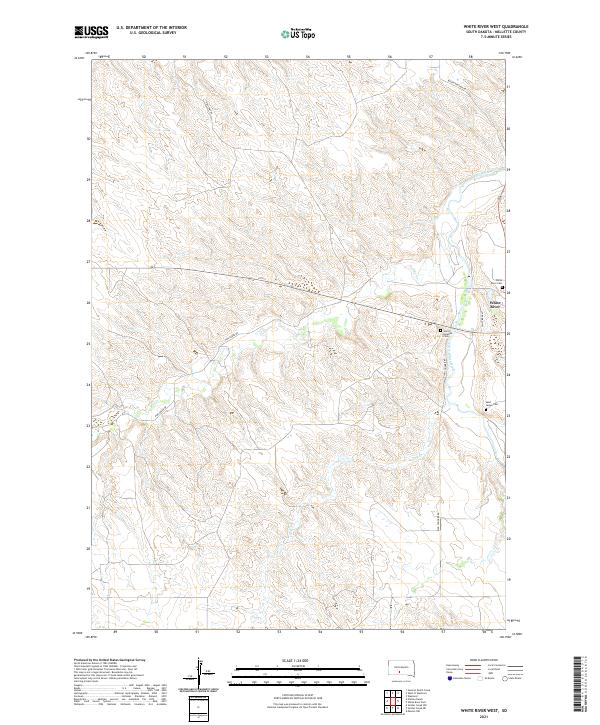
2021 Map of White River West
USGS Topo · Published 2021About this map
White River anchors the eastern edge of this Mellette County landscape, where the High Plains topography is carved by the Little White River and its western tributaries. The map reveals a rural South Dakota environment defined by vast section lines and a drainage system including Pine Cr and Dry Cr. This 2021 survey provides significant detail for genealogical research, documenting the locations of White River Cem, Saint Ignatius Cem, and Saint James Cem.
Find a feature on this map
17 named features on this map. Tap any name to fly to it.
Don’t see what you’re looking for? This feature index may not catch every label — zoom into the map to look around manually.
Map Details
Editions of this 2021 White River West Map
This is the sole edition of this map. No revisions or reprints were ever made.
Other maps of this area

1951 · Westover
USGS Topo · 1:24,000

1951 · Murdo 3 NW
USGS Topo · 1:24,000

1951 · Murdo 3 NE
USGS Topo · 1:24,000

1955 · Martin
USGS Topo · 1:250,000

1958 · Martin
USGS Topo · 1:250,000

1969 · Soldier Creek NE
USGS Topo · 1:24,000

1969 · Mission NW
USGS Topo · 1:24,000

1969 · Soldier Creek NW
USGS Topo · 1:24,000
1982 · Murdo 3 NW
USGS Topo · 1:25,000

1982 · White River East
USGS Topo · 1:24,000