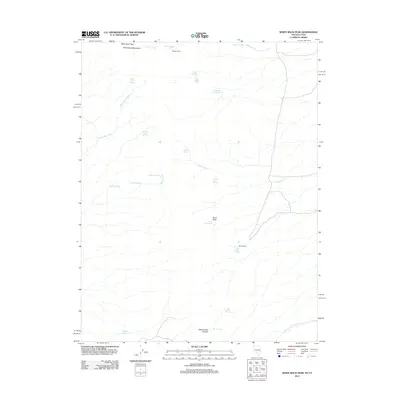
2012 Map of White Rock Peak
USGS Topo · Published 2012About this map
White Rock Peak and the surrounding White Rock Mountains define this high-desert landscape on the border of Utah and Nevada. The map highlights a remote environment where water sources are the primary points of interest for historical navigation and settlement. Numerous springs, such as Sawmill Springs, Ripgut Springs, and Devil Rock Springs, are scattered across the terrain, feeding seasonal drainages like White Rock Wash and Wildcat Wash. Human presence is represented by isolated outposts, including Scottys Cabin in the north and Reeds Cabin further south near Reeds Cabin Summit. This 2012 survey provides a clear view of the topographical features and named landmarks, such as Devil Rock, that characterize this part of Iron County.
Find a feature on this map
27 named features on this map. Tap any name to fly to it.
Don’t see what you’re looking for? This feature index may not catch every label — zoom into the map to look around manually.
Map Details
Editions of this 2012 White Rock Peak Map
This is the sole edition of this map. No revisions or reprints were ever made.
Other maps of this area

1953 · Richfield
USGS Topo · 1:250,000

1956 · Lund
USGS Topo · 1:250,000

1958 · Richfield
USGS Topo · 1:250,000

1960 · Lund
USGS Topo · 1:250,000

1971 · Steamboat Mtn SW
USGS Topo · 1:24,000

1971 · Atchison Creek
USGS Topo · 1:24,000

1972 · Gleason Basin
USGS Topo · 1:24,000

1972 · White Rock Peak
USGS Topo · 1:24,000
1972 · Rice Mountain
USGS Topo · 1:24,000

1972 · Buck Wash Well
USGS Topo · 1:24,000