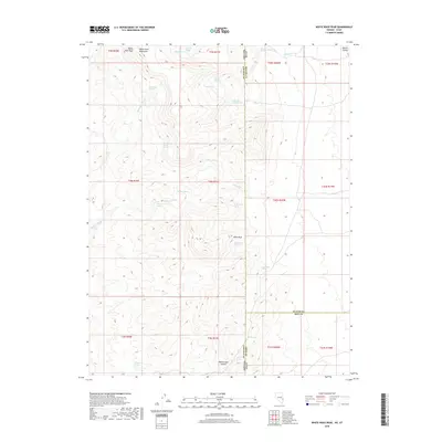
2018 Map of White Rock Peak
USGS Topo · Published 2018About this map
White Rock Peak dominates the northern reaches of the White Rock Mountains, marking a high point on the rugged border between Nevada and Utah. This high-desert landscape is defined by its seasonal water sources and intermittent drainages, such as White Rock Wash and Sawmill Cr. The concentration of named springs throughout the area, including White Rock Cabin Springs, Log Cabin Spring, and South Camp Spring, suggests a history of human activity tied to high-altitude camps and survival in an arid environment. To the east, the terrain descends toward Hamlin Valley, while southern points like Reeds Cabin Summit indicate specific sites of historical occupation or navigation. The presence of features like Sawmill Springs points to early local resource extraction, while Devil Rock stands as a notable landmark in this remote corner of Iron County.
Find a feature on this map
42 named features on this map. Tap any name to fly to it.
Don’t see what you’re looking for? This feature index may not catch every label — zoom into the map to look around manually.
Map Details
Editions of this 2018 White Rock Peak Map
This is the sole edition of this map. No revisions or reprints were ever made.
Other maps of this area

1953 · Richfield
USGS Topo · 1:250,000

1956 · Lund
USGS Topo · 1:250,000

1958 · Richfield
USGS Topo · 1:250,000

1960 · Lund
USGS Topo · 1:250,000

1971 · Steamboat Mtn SW
USGS Topo · 1:24,000

1971 · Atchison Creek
USGS Topo · 1:24,000

1972 · Gleason Basin
USGS Topo · 1:24,000

1972 · White Rock Peak
USGS Topo · 1:24,000
1972 · Rice Mountain
USGS Topo · 1:24,000

1972 · Buck Wash Well
USGS Topo · 1:24,000