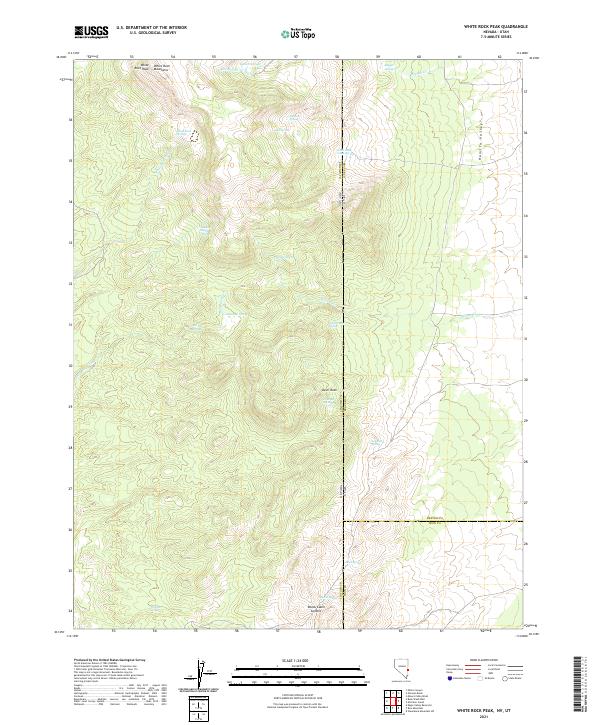
2021 Map of White Rock Peak
USGS Topo · Published 2021About this map
White Rock Peak anchors this high-elevation landscape along the border of Nevada and Utah, where the White Rock Mountains rise above the western edge of Hamlin Valley. This arid terrain is defined by a complex network of seasonal watercourses and critical water sources that would have sustained early transit and livestock in the Great Basin. Points like Sawmill Springs and White Rock Cabin Springs suggest historical human activity and resource management in these highlands. The map also traces the drainage patterns of White Rock Wash and Wildcat Wash, which descend toward the valley floor. Near the southern boundary, Reeds Cabin Summit marks a key pass, accompanied by a cluster of named water points including Mud Spring and Ticapoo Spring. The detailed section lines and county boundaries, including the intersection of Lincoln, Beaver, and Iron counties, highlight the jurisdictional complexity of this remote borderland.
Find a feature on this map
36 named features on this map. Tap any name to fly to it.
Don’t see what you’re looking for? This feature index may not catch every label — zoom into the map to look around manually.
Map Details
Editions of this 2021 White Rock Peak Map
This is the sole edition of this map. No revisions or reprints were ever made.
Other maps of this area

1953 · Richfield
USGS Topo · 1:250,000

1956 · Lund
USGS Topo · 1:250,000

1958 · Richfield
USGS Topo · 1:250,000

1960 · Lund
USGS Topo · 1:250,000

1971 · Steamboat Mtn SW
USGS Topo · 1:24,000

1971 · Atchison Creek
USGS Topo · 1:24,000

1972 · Gleason Basin
USGS Topo · 1:24,000

1972 · White Rock Peak
USGS Topo · 1:24,000
1972 · Rice Mountain
USGS Topo · 1:24,000

1972 · Buck Wash Well
USGS Topo · 1:24,000