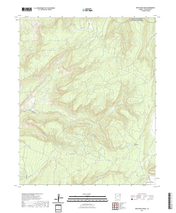
2021 Map of White Rock Wash
USGS Topo · Published 2021About this map
Canyon de Chelly National Monument occupies the northeastern corner of this Apache County landscape, where high-desert mesas give way to deeply incised drainages. The topography is defined by the Defiance Plateau, a region marked by significant elevation changes and seasonal watercourses such as White Rock Wash and Rock Top Wash. Prominent geological landmarks like Fluted Rock and Upper Forest Mtn dominate the horizon, while the descent into Nazlini Canyon reveals the intricate path of Nazlini Creek. Isolated water sources, including Honeymoon Spring and White Rock Spring, provided essential points of relief in this arid environment long before the formalization of modern roads like Indian Rte 7 and Indian Rte 26. This recent survey illustrates a remote section of the Navajo Nation where traditional land boundaries and natural hydrology continue to dictate the pace of movement across the high plateau.
Find a feature on this map
21 named features on this map. Tap any name to fly to it.
Don’t see what you’re looking for? This feature index may not catch every label — zoom into the map to look around manually.
Map Details
Editions of this 2021 White Rock Wash Map
This is the sole edition of this map. No revisions or reprints were ever made.
Other maps of this area

1886 · Fort Defiance
USGS Topo · 1:250,000

1892 · Fort Defiance
USGS Topo · 1:250,000

1892 · Canyon De Chelly
USGS Topo · 1:250,000

1954 · Shiprock
USGS Topo · 1:250,000

1954 · Gallup
USGS Topo · 1:250,000

1955 · Zith-Tusayan Butte 2 SE
USGS Topo · 1:24,000

1955 · Zith-Tusayan Butte 2 SW
USGS Topo · 1:24,000

1955 · Zith-Tusayan Butte 2 NW
USGS Topo · 1:24,000

1955 · Zith-Tusayan Butte 2 NE
USGS Topo · 1:24,000

1955 · Sonsala Butte 3 SE
USGS Topo · 1:24,000