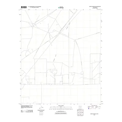
2010 Map of White Sands NE
USGS Topo · Published 2010About this map
White Sands Missile Range dominates this 2010 topographic record of the Tularosa Valley in Otero County. The landscape is defined by its military infrastructure, exhibiting a specialized network of primary and secondary transit routes such as WSMR P Route 2 and WSMR P Route 15. These roads serve the high-tech testing grounds and facilities characteristic of the region's mid-century defense expansion. Unlike typical residential maps, the development here follows a strict functional grid and arterial system, including WSMR S Route 257 and WSMR S Route 3570, which connect various remote test sites and administrative centers across the desert floor. This specialized layout provides a technical perspective on the spatial organization of New Mexico's defense sector as it existed in the early 21st century.
Find a feature on this map
11 named features on this map. Tap any name to fly to it.
Don’t see what you’re looking for? This feature index may not catch every label — zoom into the map to look around manually.
Map Details
Editions of this 2010 White Sands NE Map
This is the sole edition of this map. No revisions or reprints were ever made.
Other maps of this area

1916 · Point Of Sands
USGS Topo · 1:125,000

1940 · Orogrande
USGS Topo · 1:62,500

1943 · Parker Lake
USGS Topo · 1:62,500

1943 · Orogrande
USGS Topo · 1:62,500

1947 · Lake Lucero
USGS Topo · 1:62,500

1948 · Davies Tank
USGS Topo · 1:24,000

1948 · El Wood
USGS Topo · 1:24,000
1948 · Parker Lake SE
USGS Topo · 1:24,000

1948 · Elephant Mountain
USGS Topo · 1:24,000
1948 · Parker Lake NE
USGS Topo · 1:24,000