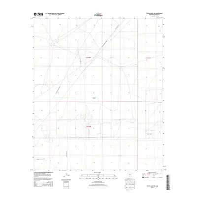
2013 Map of White Sands NE
USGS Topo · Published 2013About this map
Tularosa Valley defines the topography of this high-desert landscape within the White Sands Missile Range. In the early 21st century, this area remains a strictly controlled military environment, characterized by an sparse network of service roads and designated survey boundaries. The map documents the specific locations of WSMR S Route 220, WSMR S Route 202, and WSMR S Route 257 as they cross the basin. The presence of section lines and township markers, such as t21s r6e and t22s r7e, indicates the underlying public land survey system that exists even within the restricted missile range territory.
Find a feature on this map
10 named features on this map. Tap any name to fly to it.
Don’t see what you’re looking for? This feature index may not catch every label — zoom into the map to look around manually.
Map Details
Editions of this 2013 White Sands NE Map
This is the sole edition of this map. No revisions or reprints were ever made.
Other maps of this area

1916 · Point Of Sands
USGS Topo · 1:125,000

1940 · Orogrande
USGS Topo · 1:62,500

1943 · Parker Lake
USGS Topo · 1:62,500

1943 · Orogrande
USGS Topo · 1:62,500

1947 · Lake Lucero
USGS Topo · 1:62,500

1948 · Davies Tank
USGS Topo · 1:24,000

1948 · El Wood
USGS Topo · 1:24,000
1948 · Parker Lake SE
USGS Topo · 1:24,000

1948 · Elephant Mountain
USGS Topo · 1:24,000
1948 · Parker Lake NE
USGS Topo · 1:24,000