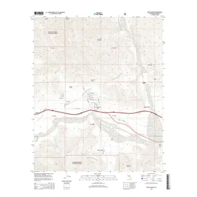
2015 Map of White Water
USGS Topo · Published 2015About this map
San Gorgonio Pass serves as the primary corridor for human movement and infrastructure in this desert landscape, where the San Bernardino Mountains and San Jacinto Mountains converge. The map documents a critical infrastructure network, including the Colorado River Aqueduct, which winds through the hills, and the Railroad Ave corridor paralleling Interstate 10. Small settlements like Bonnie Bell, White Water, and Snow Creek are positioned at the mouths of canyons where water traditionally emerged from the high peaks. The presence of the Pacific Crest National Scenic Trail crossing the quadrangle highlights the area's role as a major geographical junction. For the historian or researcher, the map preserves the exact layout of residential streets in the hills, such as Kalsman Dr and Haugen Lehmann Way, alongside natural landmarks like One Horse Ridge and Painted Hill.
Find a feature on this map
57 named features on this map. Tap any name to fly to it.
Don’t see what you’re looking for? This feature index may not catch every label — zoom into the map to look around manually.
Map Details
Editions of this 2015 White Water Map
This is the sole edition of this map. No revisions or reprints were ever made.
Other maps of this area

1901 · Southern California Sheet No. 1
USGS Topo · 1:250,000

1901 · San Jacinto
USGS Topo · 1:125,000

1902 · San Gorgonio
USGS Topo · 1:125,000

1904 · Southern California Sheet No. 1
USGS Topo · 1:250,000

1940 · Palm Springs
USGS Topo · 1:62,500

1942 · Banning
USGS Topo · 1:62,500

1943 · Banning
USGS Topo · 1:62,500

1944 · Palm Springs
USGS Topo · 1:62,500

1947 · Santa Ana
USGS Topo · 1:250,000

1949 · Santa Ana
USGS Topo · 1:250,000