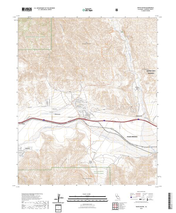
2023 Map of White Water
USGS Topo · Published 2023About this map
San Gorgonio Pass serves as a critical geographic gateway between the San Bernardino Mountains and the San Jacinto Mountains, funneling both transportation and water through this high-desert corridor. The modern landscape is defined by the braided path of the Whitewater River and the San Gorgonio River, which originate in the surrounding wilderness areas. Small settlements like Bonnie Bell and Snow Creek sit at the desert’s edge, where the terrain shifts from steep ridges like One Horse Ridge to the broad, wind-swept valley floor. The Pacific Crest National Scenic Trl traverses the northern heights, passing near landmarks such as The Matterdome and Kitching Peak. This mapping identifies the intricate network of local desert roads, including Haugen Lehman Way and Whitewater Canyon Rd, which connect these isolated mountain communities to the primary transit routes through the pass.
Find a feature on this map
67 named features on this map. Tap any name to fly to it.
Don’t see what you’re looking for? This feature index may not catch every label — zoom into the map to look around manually.
Map Details
Editions of this 2023 White Water Map
This is the sole edition of this map. No revisions or reprints were ever made.
Other maps of this area

1901 · Southern California Sheet No. 1
USGS Topo · 1:250,000

1901 · San Jacinto
USGS Topo · 1:125,000

1902 · San Gorgonio
USGS Topo · 1:125,000

1904 · Southern California Sheet No. 1
USGS Topo · 1:250,000

1940 · Palm Springs
USGS Topo · 1:62,500

1942 · Banning
USGS Topo · 1:62,500

1943 · Banning
USGS Topo · 1:62,500

1944 · Palm Springs
USGS Topo · 1:62,500

1947 · Santa Ana
USGS Topo · 1:250,000

1949 · Santa Ana
USGS Topo · 1:250,000