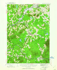
1935 Map of Whitefield
USGS Topo · Published 1961About this map
Whitefield and Bethlehem center a landscape defined by the intersection of northern New Hampshire's rail networks and mountain recreation in the mid-1930s. The Maine Central RR and Boston and Maine RR carve paths through the valley, meeting at transit hubs like Quebec Junction and Wing Road. Aviation history is visible at both the Whitefield Landing Field and the Twin Mountain Landing Field, serving the growing tourism interest in the White Mountain National Forest. High points such as Mt Agassiz, which features a Fire Tower, and Mt Pleasant overlook a terrain dotted with rural schools like the East Whitefield Sch and Cushman Sch. The map also captures local family history through numerous cemeteries including Baptist Hill Cem and Riverside Cem, while a CCC Camp near the Ammonoosuc River indicates Great Depression-era public works projects in the region.
Find a feature on this map
105 named features on this map. Tap any name to fly to it.
Don’t see what you’re looking for? This feature index may not catch every label — zoom into the map to look around manually.
Map Details
Editions of this 1935 Whitefield Map
4 editions found

Other maps of this area

1893 · Mt. Washington
USGS Topo · 1:62,500

1895 · Crawford Notch
USGS Topo · 1:62,500

1896 · Mt. Washington
USGS Topo · 1:62,500

1896 · Crawford Notch
USGS Topo · 1:62,500

1900 · Whitefield
USGS Topo · 1:62,500

1920 · Guildhall
USGS Topo · 1:62,500

1929 · Moosilauke
USGS Topo · 1:62,500

1929 · Franconia
USGS Topo · 1:62,500

1930 · Percy
USGS Topo · 1:62,500

1931 · Guildhall
USGS Topo · 1:48,000