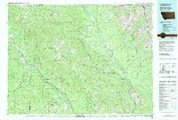
1981 Map of Whitefish Range
USGS Topo · Published 1982About this map
The Whitefish Range dominates this 1980s landscape, serving as a massive topographical spine between the Kootenai National Forest and the Flathead National Forest. This survey captures the wilderness character of the region just before the modern era of intensive recreational development, showing the remote northern reaches of Glacier National Park including Kintla Lake and Bowman Lake. The North Fork Flathead River carves a deep valley that defines the eastern edge of the range, while the Burlington Northern railroad corridor provides the primary industrial link through the western valleys, connecting the small settlements of Trego, Fortine, and Olney. Grounded in data from the late 1960s through 1981, the map documents the complex network of forest service roads and high-elevation landmarks like Stahl Peak and Whitefish Mountain that supported the region's logging and fire management infrastructure.
Find a feature on this map
143 named features on this map. Tap any name to fly to it.
Don’t see what you’re looking for? This feature index may not catch every label — zoom into the map to look around manually.
Map Details
Editions of this 1981 Whitefish Range Map
This is the sole edition of this map. No revisions or reprints were ever made.
Other maps of this area

1904 · Chief Mountain
USGS Topo · 1:125,000

1906 · Kintla Lakes
USGS Topo · 1:125,000

1913 · Stryker
USGS Topo · 1:125,000

1914 · Nyack
USGS Topo · 1:125,000

1916 · Stryker
USGS Topo · 1:125,000

1920 · Jennings
USGS Topo · 1:125,000

1935 · Thompson Lakes
USGS Topo · 1:96,000

1938 · Chief Mountain
USGS Topo · 1:125,000

1938 · Kintla Lakes
USGS Topo · 1:125,000

1942 · Thompson Lakes
USGS Topo · 1:125,000