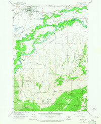
1963 Map of Whitehall
USGS Topo · Published 1965About this map
The town of Whitehall serves as a central hub in this Montana valley, where the Northern Pacific and Chicago Milwaukee St Paul and Pacific railroads converge. The landscape is defined by the winding course of the Jefferson River and its intricate drainage systems, including Big Pipestone Creek and Whitetail Creek. To the south, the terrain rises sharply into the Tobacco Root Mountains within the Deerlodge National Forest, a region marked by geological prospecting and extraction.
Find a feature on this map
47 named features on this map. Tap any name to fly to it.
Don’t see what you’re looking for? This feature index may not catch every label — zoom into the map to look around manually.
Map Details
Editions of this 1963 Whitehall Map
2 editions found
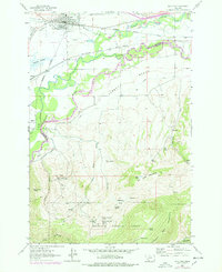
Other maps of this area

1888 · Three Forks
USGS Topo · 1:250,000

1893 · Dillon
USGS Topo · 1:250,000

1894 · Three Forks
USGS Topo · 1:250,000

1895 · Three Forks
USGS Topo · 1:250,000

1947 · Bozeman
USGS Topo · 1:250,000

1948 · Bozeman
USGS Topo · 1:250,000

1950 · Jefferson Island
USGS Topo · 1:62,500

1950 · Harrison
USGS Topo · 1:62,500

1955 · Bozeman
USGS Topo · 1:250,000

1955 · Dillon
USGS Topo · 1:250,000
Featured Places
- Whitehall, MT
- La Casa Trailer Park, Whitehall
- Rice Motel and Trailer Court, Whitehall
- Madison County, MT
- Jefferson County, MT