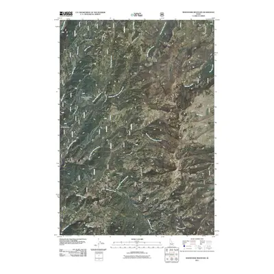
2011 Map of Whitehawk Mountain
USGS Topo · Published 2011About this map
The Mary Blue Mine is a notable landmark in this 2011 survey, situated within a drainage network defined by Granite Creek and Wilson Creek. The landscape is dominated by the high elevations of Whitehawk Mountain and the surrounding Whitehawk Basin, which serve as a primary watershed for numerous branching tributaries. These waters, including Warm Springs Creek and its distinctive Middle Fork and East Fork, eventually feed the Deadwood River along the western edge of the quadrangle.
Find a feature on this map
19 named features on this map. Tap any name to fly to it.
Don’t see what you’re looking for? This feature index may not catch every label — zoom into the map to look around manually.
Map Details
Editions of this 2011 Whitehawk Mountain Map
This is the sole edition of this map. No revisions or reprints were ever made.
Other maps of this area

1891 · Bear Valley
USGS Topo · 1:125,000

1893 · Bear Valley
USGS Topo · 1:125,000

1909 · Garden Valley
USGS Topo · 1:125,000

1953 · Deadwood Reservoir
USGS Topo · 1:62,500

1957 · Challis
USGS Topo · 1:250,000

1960 · Challis
USGS Topo · 1:250,000

1963 · Challis
USGS Topo · 1:250,000

1972 · Cache Creek
USGS Topo · 1:24,000
1972 · Miller Mtn East
USGS Topo · 1:24,000

1972 · Scott Creek
USGS Topo · 1:24,000