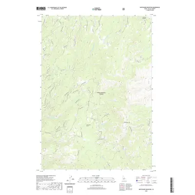
2020 Map of Whitehawk Mountain
USGS Topo · Published 2020About this map
Boise National Forest dominates this high-elevation terrain in Valley County, where the landscape is defined by the complex drainage systems of Warm Springs Cr and the Middle Fork Warm Springs Cr. The area is centered on the prominent Whitehawk Mtn, a peak served by the high-altitude Whitehawk Lookout. For the researcher, the map details a massive network of Forest Service spurs and timber access roads, including the Whitehawk North Spur and Big Buck South Spur, which trace the ridges between deep basins. Geological and navigational landmarks like Bearskin Meadows and the dual depressions of Whitehawk Basin and Old Whitehawk Basin offer insights into the natural hydrology and historical naming conventions of this backcountry region. The presence of the Warm Springs Overlook suggests the significance of these vistas for fire management and forestry operations in the modern era.
Find a feature on this map
36 named features on this map. Tap any name to fly to it.
Don’t see what you’re looking for? This feature index may not catch every label — zoom into the map to look around manually.
Map Details
Editions of this 2020 Whitehawk Mountain Map
This is the sole edition of this map. No revisions or reprints were ever made.
Other maps of this area

1891 · Bear Valley
USGS Topo · 1:125,000

1893 · Bear Valley
USGS Topo · 1:125,000

1909 · Garden Valley
USGS Topo · 1:125,000

1953 · Deadwood Reservoir
USGS Topo · 1:62,500

1957 · Challis
USGS Topo · 1:250,000

1960 · Challis
USGS Topo · 1:250,000

1963 · Challis
USGS Topo · 1:250,000

1972 · Cache Creek
USGS Topo · 1:24,000
1972 · Miller Mtn East
USGS Topo · 1:24,000

1972 · Scott Creek
USGS Topo · 1:24,000