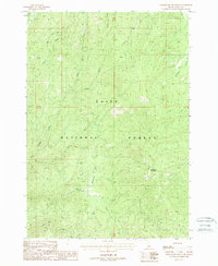
1988 Map of Whitehawk Mountain
USGS Topo · Published 1988About this map
The rugged Boise National Forest dominates this 1980s landscape, centered on the high terrain of Whitehawk Mountain. The map details a complex drainage network feeding into the Deadwood River at the northwestern corner, including the Middle Fork and South Fork river systems. Near the headwaters of Granite Creek, the Mary Blue Mine stands as a solitary industrial marker in an otherwise wilderness-dominated region. The map captures the area as it appeared in 1988, showing the relationship between the Whitehawk Basin and the numerous named tributaries like Bearskin Creek and No Man Creek that carve through the mountain slopes. This provisional survey is particularly useful for understanding the hydrologic patterns and remote mining sites within Valley County's wilderness during the late twentieth century.
Find a feature on this map
19 named features on this map. Tap any name to fly to it.
Don’t see what you’re looking for? This feature index may not catch every label — zoom into the map to look around manually.
Map Details
Editions of this 1988 Whitehawk Mountain Map
This is the sole edition of this map. No revisions or reprints were ever made.
Other maps of this area

1891 · Bear Valley
USGS Topo · 1:125,000

1893 · Bear Valley
USGS Topo · 1:125,000

1909 · Garden Valley
USGS Topo · 1:125,000

1953 · Deadwood Reservoir
USGS Topo · 1:62,500

1957 · Challis
USGS Topo · 1:250,000

1960 · Challis
USGS Topo · 1:250,000

1963 · Challis
USGS Topo · 1:250,000

1972 · Cache Creek
USGS Topo · 1:24,000
1972 · Miller Mtn East
USGS Topo · 1:24,000

1972 · Scott Creek
USGS Topo · 1:24,000