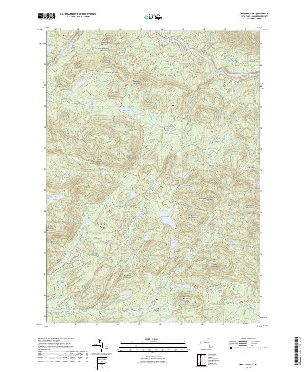
2023 Map of Whitehouse
USGS Topo · Published 2023About this map
The West Branch Sacandaga River defines the drainage of this wild Hamilton County landscape, where the Northville-Placid Trl winds through a dense cluster of Adirondack peaks. This modern survey illustrates a topography of high summits and secluded water bodies, including the significant Silver Lake and the smaller Meco Lake tucked beneath Silver Lake Mountain. The terrain is characterized by a series of distinct heights such as Sugarloaf Mountain, Big Hedgehog Mountain, and Blue Ridge Mountain. Local water features like Goldmine Creek and Silver Lake Outlet connect the high-elevation ponds to the river system. The presence of W River Rd and the Unmarked Trl suggests the limited infrastructure typical of this wilderness area, making the map a essential guide for understanding the primitive routes through the southern Adirondacks.
Find a feature on this map
40 named features on this map. Tap any name to fly to it.
Don’t see what you’re looking for? This feature index may not catch every label — zoom into the map to look around manually.
Map Details
Editions of this 2023 Whitehouse Map
This is the sole edition of this map. No revisions or reprints were ever made.
Other maps of this area

1901 · Lassellsville
USGS Topo · 1:62,500

1903 · Gloversville
USGS Topo · 1:62,500

1903 · Lassellsville
USGS Topo · 1:62,500

1904 · Piseco Lake
USGS Topo · 1:62,500

1906 · Piseco Lake
USGS Topo · 1:62,500

1907 · Lake Pleasant
USGS Topo · 1:62,500

1908 · Piseco Lake
USGS Topo · 1:62,500

1943 · Gloversville
USGS Topo · 1:62,500

1945 · Caroga Lake
USGS Topo · 1:24,000
1945 · Canada Lake
USGS Topo · 1:24,000