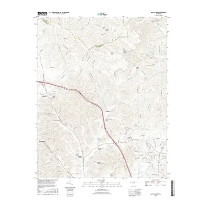
2016 Map of Whites Creek
USGS Topo · Published 2016About this map
Paradise Ridge and Dividing Ridge define the upland landscape of the Davidson and Robertson county line, where winding roads like Ivey Point Rd and Winding Ridge Rd trace the local topography. This 2016 survey shows the community of Joelton situated at a high point near Devils Elbow, serving as a gateway to the valleys below. The drainage patterns of Earthman Fork and Whites Creek have shaped the settlement locations, with clusters of development at Lickton and the village of Whites Creek itself. Genealogists will find several burial grounds across the ridges, including Beech Grove Cem, Spring Hill Cem, and Dukes Cem. Small water bodies such as Crocker Springs Lake and Browns Lake dot the landscape, illustrating the suburban and rural transition of the Nashville periphery.
Find a feature on this map
128 named features on this map. Tap any name to fly to it.
Don’t see what you’re looking for? This feature index may not catch every label — zoom into the map to look around manually.
Map Details
Editions of this 2016 Whites Creek Map
This is the sole edition of this map. No revisions or reprints were ever made.
Other maps of this area

1903 · Nashville
USGS Topo · 1:125,000

1931 · Ridgetop
USGS Topo · 1:62,500

1932 · Hermitage
USGS Topo · 1:62,500

1932 · Nashville
USGS Topo · 1:62,500

1935 · Ridgetop
USGS Topo · 1:62,500

1942 · Gallatin
USGS Topo · 1:100,000

1942 · Lebanon
USGS Topo · 1:100,000

1952 · Goodlettsville
USGS Topo · 1:24,000

1952 · Nashville West
USGS Topo · 1:24,000

1952 · Nashville East
USGS Topo · 1:24,000