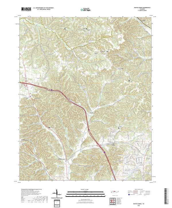
2022 Map of Whites Creek
USGS Topo · Published 2022About this map
Paradise Ridge and Dividing Ridge form the elevated backbone of this region north of Nashville, where the landscape is defined by deep hollows and narrow valleys. This 2022 survey captures a transition from the denser residential development of Germantown and Little Creek to the more rural, wooded character of Whites Creek and Lickton. The terrain is characterized by intricate drainage patterns, with Earthman Fork and Whites Cr carving through named features like Johnson Hollow and Bear Hollow. Numerous community landmarks remain preserved in the landscape, including Union Hill Cem and Beech Grove Cem, serving as critical touchpoints for genealogists. The map also highlights established transportation routes such as Lickton Pike and Brick Church Pike, which follow the natural contours of the ridges and creek beds that have dictated settlement patterns for generations.
Find a feature on this map
140 named features on this map. Tap any name to fly to it.
Don’t see what you’re looking for? This feature index may not catch every label — zoom into the map to look around manually.
Map Details
Editions of this 2022 Whites Creek Map
This is the sole edition of this map. No revisions or reprints were ever made.
Other maps of this area

1903 · Nashville
USGS Topo · 1:125,000

1931 · Ridgetop
USGS Topo · 1:62,500

1932 · Hermitage
USGS Topo · 1:62,500

1932 · Nashville
USGS Topo · 1:62,500

1935 · Ridgetop
USGS Topo · 1:62,500

1942 · Gallatin
USGS Topo · 1:100,000

1942 · Lebanon
USGS Topo · 1:100,000

1952 · Goodlettsville
USGS Topo · 1:24,000

1952 · Nashville West
USGS Topo · 1:24,000

1952 · Nashville East
USGS Topo · 1:24,000