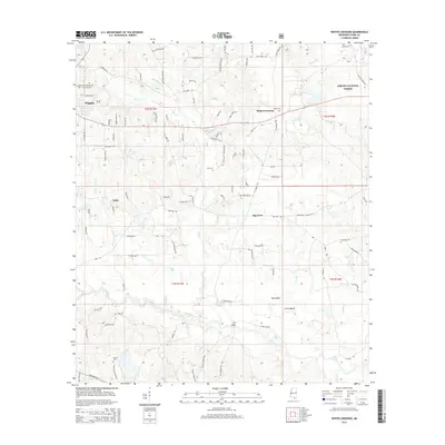
2015 Map of Whites Crossing
USGS Topo · Published 2015About this map
Wiggins sits at the western edge of this Stone County landscape, where the piney woods of the DeSoto National Forest meet a network of creek drainages. The area is defined by the winding course of Flint Creek, which feeds the Flint Creek Reservoir in the northwest before flowing south toward the wide bottomlands of Red Creek. Smaller settlements like Whites Crossing and Big Level are linked by a grid of named rural roads, many reflecting local family history such as Taylor Cemetery Rd and Bond Lott Cemetery Rd. A high density of burial sites, including Sumrall Cemetery and Whites Cemetery, provides significant data for genealogical research. The southern portion of the map reveals a more swampy terrain near the confluence of Run Branch and Blue Lake, featuring distinct landforms like the Big Island rise.
Find a feature on this map
108 named features on this map. Tap any name to fly to it.
Don’t see what you’re looking for? This feature index may not catch every label — zoom into the map to look around manually.
Map Details
Editions of this 2015 Whites Crossing Map
This is the sole edition of this map. No revisions or reprints were ever made.
Other maps of this area

1947 · Wiggins
USGS Topo · 1:62,500

1947 · Benndale
USGS Topo · 1:62,500

1949 · Wiggins
USGS Topo · 1:62,500

1949 · Benndale
USGS Topo · 1:62,500

1953 · Mobile
USGS Topo · 1:250,000

1954 · Vestry
USGS Topo · 1:62,500

1954 · McHenry
USGS Topo · 1:62,500

1957 · Mobile
USGS Topo · 1:250,000

1960 · Mobile
USGS Topo · 1:250,000

1963 · Mobile
USGS Topo · 1:250,000